Big pattern changes ahead for parched western US
A significant shift in the weather pattern beginning late this week will bring much-needed rainfall and cooler air to areas of the western United States beleaguered with wildfires and drought.
"This is welcome news for firefighters on the front lines fighting a number of large blazes that have scorched millions of acres across the West as well as those who are suffering from poor air quality," AccuWeather Senior Meteorologist Alex Sosnowski said.
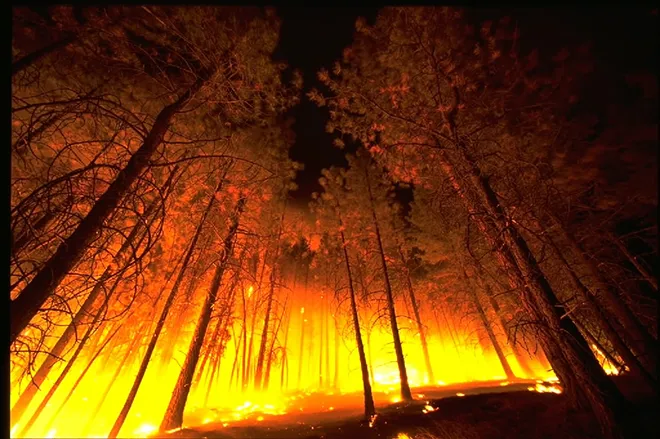
On Sunday, Cal Fire officials announced that a record 4 million acres have been scorched in California so far this fire season, more than doubling the previous record for the most acreage burned in the state in a year.
“The 4 million mark is unfathomable. It boggles the mind, and it takes your breath away. And that number will grow," Scott McLean, a spokesman for Cal Fire, said according to The Associated Press.
Year-to-date, over 7.7 million acres of land across the U.S. have been burned by wildfires.
Forecasters say it is too early to detail specific rainfall amounts, but enough rain to douse some of the active wildfires and give firefighters the upper hand in the Northwest and Northern California is expected with the pattern change late in the week.
The pattern change will result from a southward dip in the jet stream, which will allow Pacific moisture to flow in freely across the region.
"This setup will help not only to drive moisture inland from the Pacific but also to lower temperatures substantially over the western quarter to third of the nation," Sosnowski said.
Last week, AccuWeather meteorologists were pondering the possibility of moisture from former Hurricane Marie possibly coming into play and enhancing rainfall across the West. While this scenario no longer seems likely with Marie expected to dissipate while drifting westward across the open Pacific, significant rainfall is still likely across the region.
One batch of rain may arrive in California at week's end, prior to a more potent storm system taking aim at the Northwest and Northern California by the weekend.
"Flash floods, mudslides and debris flows are possible near the areas that burned recently in Washington and Oregon," AccuWeather Lead Long-Range Meteorologist Paul Pastelok said.
Burn scar areas in higher terrain pose a particularly dangerous risk to communities downstream. People living near burn scar areas or active blazes should pay close attention to the weather situation heading into the weekend.
Even in the absence of flooding and mudslides, the rainfall can lead to travel delays on the road and in the air. Drivers on stretches of interstates 5, 82, 84 and 90 should be prepared to slow down during periods of steadier rainfall, as visibility will be reduced and there will be a heightened risk of hydroplaning at highway speeds.
It is not out of the question for enough chilly air to sweep in for snow to fall on the highest elevations of the Cascades and northern Rockies, largely above pass level.
"Even with the upcoming forecast pattern change, there will likely to continue to be large fires burning, and some areas could be missed by significant rainfall," Sosnowski said.
In fact, the shift in the weather pattern could enhance the fire danger in some areas of the West, due to an increase of gusty winds.
"South of where the rain falls, winds will be gusty, especially across the interior Southwest and east through the Rockies, heightening the fire danger," Pastelok said.
Southern California may be another troublesome area where offshore winds will howl.
AccuWeather meteorologists will continue to monitor the latest information this week, providing more details as they unfold.
The upcoming shift in the pattern could be a taste of what's to come this winter, as AccuWeather's team of long-range meteorologists expect the wet season to kick off early across the West.

