Cheyenne Wells hits 103 Monday before storms bring midweek relief to Cheyenne County

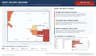
Cheyenne Wells will see one more day of intense heat Monday, with a high near 103 degrees, before thunderstorms and a cooler air mass drop highs into the low 90s Tuesday and Wednesday.
Monday will be mostly sunny and hot with a high near 103 and northwest winds of 5 to 15 mph turning east in the afternoon. While heat advisories cover much of neighboring northwest Kansas Monday, none are in effect for the Colorado counties served by the Goodland forecast office. Relief arrives quickly Monday night, when a 50 percent chance of showers and thunderstorms — mainly before midnight — accompanies a low around 64.
©
“The ridge that has been in place over the Four Corners region is still likely to stay nearly stationary over the next week,” a meteorologist with the National Weather Service forecast office in Goodland, Kan., wrote in Sunday’s Area Forecast Discussion, adding that highs for the week are expected to settle back into the mid to upper 90s.
Upslope flow fuels storm chances
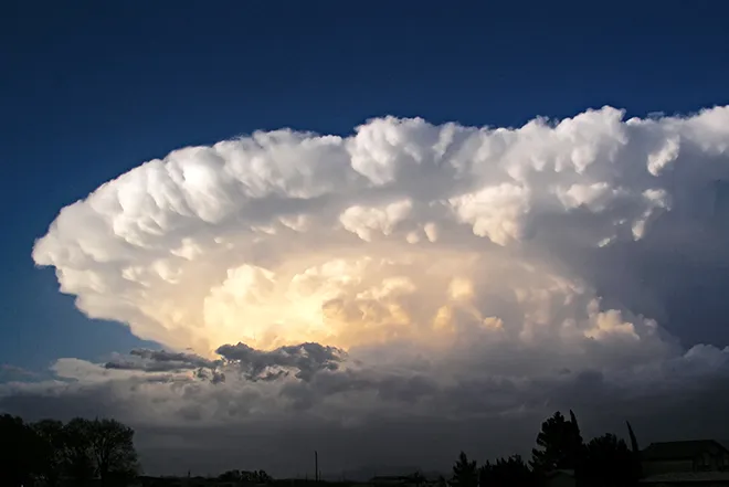
Goodland forecasters expect a surface low south of the region to remain nearly stationary Tuesday, turning winds east-northeast and promoting upslope flow that favors showers and storms. Rain chances Tuesday run 30 to 60 percent — highest in eastern Colorado — though any storms that develop are expected to stay on the marginal side for severe potential.
Wednesday carries the highest precipitation chances of the week, 40 to 65 percent, as a shortwave moves through during the afternoon and evening. Eastern Colorado has a 25 to 45 percent chance of picking up more than a tenth of an inch of rain. No fire weather warnings are in effect for Cheyenne County.
Cheyenne Wells, Colo. — Five-day forecast (July 27-31)
Source: National Weather Service, Goodland, Kan. — Issued July 26, 2026
| Period | Sky Conditions | High/Low | Wind |
|---|---|---|---|
| Monday | Mostly sunny and hot | 103 | Northwest 5-15 mph, becoming east in the afternoon |
| Monday Night | Mostly cloudy; 50% chance t-storms before midnight | 64 | Northeast 10-15 mph, becoming north after midnight |
| Tuesday | Mostly cloudy, then gradually sunny | 93 | North around 10 mph, becoming east in the afternoon |
| Tuesday Night | Mostly cloudy; 40% chance showers and t-storms before 3 a.m. | 63 | East 5-10 mph, becoming northeast after midnight |
| Wednesday | Mostly sunny; 20% chance p.m. t-storms | 94 | Light and variable |
| Wednesday Night | Partly cloudy; 50% chance showers and t-storms before midnight | 64 | Light and variable |
| Thursday | Mostly sunny | 96 | Light and variable |
| Thursday Night | Mostly clear; 20% chance t-storms before midnight | 63 | Light and variable |
| Friday | Sunny | 94 | Light and variable |
| Friday Night | Mostly clear; 20% chance t-storms | 61 | Light and variable |
(Kiowa County Press)
Tuesday and Wednesday
Tuesday will begin mostly cloudy before gradually turning sunny, with a high near 93 and north winds around 10 mph becoming east in the afternoon. Tuesday night brings a 40 percent chance of showers and storms before 3 a.m., with a low around 63.
Wednesday looks mostly sunny with a high near 94 and a 20 percent chance of afternoon storms, followed by a 50 percent chance of showers and storms Wednesday night before midnight, with a low around 64.
Extended outlook
Thursday will be mostly sunny with a high near 96, with a 20 percent chance of storms Thursday night. Friday looks sunny with a high near 94, and storm chances taper to 10 to 20 percent each day heading into the weekend.
Looking further ahead, the Climate Prediction Center’s outlook issued Sunday favors above-normal temperatures and below-normal precipitation for Colorado Aug. 1-5, with above-normal temperatures continuing to be favored Aug. 3-9, suggesting heat will rebuild across the eastern plains heading into early August.
Even without a formal advisory, Monday’s triple-digit heat warrants caution: limit outdoor exertion during the afternoon, drink plenty of water, and never leave children or pets unattended in vehicles.