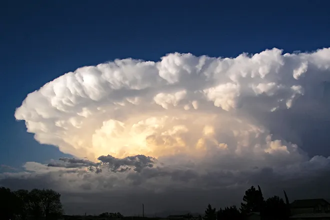
Eads hits 100 Wednesday as storm chances return to Kiowa County

Hot, breezy conditions arrive in Eads Wednesday, with a high near 100 degrees and thunderstorm chances building into the evening, followed by a mostly sunny Thursday near 95 and a sunny Friday with a high near 95 to close out the workweek.
Wednesday brings sunny, hot conditions with a high near 100. South-southeast winds of 15 to 25 mph will keep the day breezy, and there is a 20 percent chance of showers and thunderstorms after 5 p.m. Wednesday night, the chance of storms rises to 50 percent, mainly before 11 p.m., with increasing clouds and a low around 64. Southeast winds of 15 to 20 mph could gust as high as 30 mph.
"It will continue to be hot across the plains tomorrow and 100s are likely once again from Pueblo east to the KS border," Stephen Hodanish, a meteorologist with the National Weather Service in Pueblo, wrote in Tuesday's Area Forecast Discussion.
Storm chances offer hope for rain
The National Weather Service in Pueblo continues to highlight deepening drought across south central and southeast Colorado, and this week's forecast offers at least a chance of meaningful moisture. The best opportunity for rain in Kiowa County comes Thursday night, when showers are likely before midnight with a 70 percent chance of precipitation and rainfall amounts between a quarter and half of an inch possible. No watches, warnings or advisories were in effect for the Pueblo forecast area as of Tuesday afternoon.
Eads, Colo. — Five-day forecast (July 22-26, 2026)
Source: National Weather Service, Pueblo, Colo. — Issued July 21, 2026
| Period | Sky Conditions | High/Low | Wind |
|---|---|---|---|
| Wednesday | Sunny, hot; slight chance of p.m. t-storms | High 100 | SSE 15-25 mph |
| Wednesday Night | 50% t-storms before 11 p.m.; increasing clouds | Low 64 | SE 15-20 mph, gusts to 30 mph |
| Thursday | Mostly sunny; slight chance of late p.m. storms | High 95 | NNE 5-10 mph |
| Thursday Night | Showers likely before midnight (70%) | Low 61 | N 5-10 mph |
| Friday | Sunny | High 95 | NW around 5 mph, becoming E in the afternoon |
| Friday Night | Partly cloudy | Low 64 | ESE around 5 mph |
| Saturday | Sunny | High 99 | SE 5-10 mph |
| Saturday Night | Partly cloudy | Low 65 | SE 5-10 mph |
| Sunday | Sunny, hot | High 101 | S 5-10 mph |
| Sunday Night | Partly cloudy | Low 69 | SSE 5-10 mph, becoming SW after midnight |
(Kiowa County Press)
Thursday and Friday
Thursday will be mostly sunny with a high near 95 and north-northeast winds of 5 to 10 mph, along with a slight chance of showers and thunderstorms after 3 p.m. Showers are likely Thursday night before midnight under mostly cloudy skies, with a low around 61 and rainfall amounts between a quarter and half of an inch possible. Friday turns sunny with a high near 95 and light winds becoming easterly in the afternoon, followed by a partly cloudy night with a low around 64.
Extended outlook
The weekend turns hot and dry. Saturday will be sunny with a high near 99 and a partly cloudy night around 65. Sunday brings more sunshine and heat, with a high near 101 and southerly winds of 5 to 10 mph.
With temperatures at or near triple digits several days this week, residents should limit strenuous outdoor activity during the hottest part of the day, drink plenty of water and check on neighbors, pets and livestock.