Heat advisory for Lamar Monday as temperatures soar to 106 before midweek storms

A Heat Advisory is in effect for Lamar from 11 a.m. to 7 p.m. Monday as Prowers County endures the hottest stretch of the week, with a high near 106 Monday followed by 103 Tuesday and 102 Wednesday before thunderstorms usher in a substantial cooldown.
Monday will be sunny and dangerously hot, with south winds of 5 to 10 mph becoming west in the morning. Monday night brings a slight chance of showers and thunderstorms before 10 p.m. — a 20 percent chance overall — under partly cloudy skies with a low around 66.
“Concern for heavy rainfall and flash flooding will increase from late week into the weekend, especially over recent burn scars,” Eric Petersen, a meteorologist with the National Weather Service in Pueblo, wrote in Sunday's Area Forecast Discussion.
Three days of extreme heat, then a pattern flip
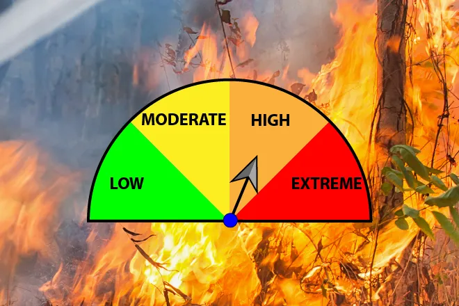
The advisory-level heat comes as an upper-level high drifts east through New Mexico, holding afternoon temperatures at or above 102 in Lamar through Wednesday. No Red Flag Warning is in effect for Prowers County, but the combination of triple-digit heat, low humidity and afternoon breezes will keep fire danger elevated until wetter weather arrives.
That change looks substantial. As the high shifts to the southern Plains and beyond, moisture wrapping around its western flank is expected to fuel widespread showers and thunderstorms from Wednesday night into the weekend, dropping highs nearly 20 degrees by Friday. Forecasters cautioned that slow-moving storms could produce heavy rainfall and localized flash flooding late in the week, especially near recent burn scars.
Lamar, Colo. — Five-day forecast (Aug. 10-14, 2026)
Source: National Weather Service, Pueblo — Issued Aug. 9, 2026
| Period | Sky Conditions | High/Low | Wind |
|---|---|---|---|
| Monday | Sunny, hot; Heat Advisory 11 a.m.-7 p.m. | 106°F | S 5-10 mph, becoming W in the morning |
| Monday night | Slight chance t-storms early, partly cloudy | 66°F | SE 5-15 mph, becoming W after midnight |
| Tuesday | Sunny, hot | 103°F | W 5-10 mph, becoming ESE in the afternoon |
| Tuesday night | Slight chance t-storms, partly cloudy | 66°F | ESE around 5 mph, becoming W after midnight |
| Wednesday | Mostly sunny, hot | 102°F | W 5-15 mph, becoming SSE in the afternoon |
| Wednesday night | 40% t-storms before midnight | 64°F | SE 10-15 mph, becoming NNE after midnight |
| Thursday | Mostly sunny, 30% t-storms after noon | 91°F | NW around 10 mph, becoming ENE in the afternoon |
| Thursday night | Showers likely, 70% chance | 61°F | NE 5-10 mph |
| Friday | Partly sunny, 10% t-storms after noon | 87°F | NE 5-10 mph, becoming ESE in the afternoon |
| Friday night | Showers likely, possible t-storm | 61°F | NE 5-10 mph |
(Kiowa County Press)
Tuesday and Wednesday
Tuesday stays sunny and hot with a high near 103 and west winds of 5 to 10 mph turning east-southeast in the afternoon. A slight chance of evening showers and thunderstorms fades to partly cloudy skies Tuesday night with a low around 66.
Wednesday reaches near 102 under mostly sunny skies with west winds of 5 to 15 mph becoming south-southeast. The first significant storm chance arrives Wednesday night — 40 percent before midnight — with a low around 64.
Extended outlook: Thursday and Friday
Thursday cools to near 91 with a 30 percent chance of showers and thunderstorms after noon. Showers become likely Thursday night, when the chance of precipitation reaches 70 percent and the low drops to around 61. Friday looks partly sunny with a high near 87 and a slight afternoon storm chance, with showers likely again Friday night.
Pueblo forecasters expect the wet pattern to continue into the weekend, with repeated rounds of rain possibly holding highs slightly below seasonal averages by Friday and Saturday.
During Monday's advisory, residents should drink plenty of fluids, stay in air conditioning where possible, avoid strenuous outdoor activity during the afternoon, and never leave children or pets in vehicles. Similar precautions are wise Tuesday and Wednesday as triple-digit heat lingers.