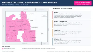
Red Flag Warning returns to western Colorado and the mountains for a second day

For a second straight day, a Red Flag Warning covered much of western Colorado and the state's mountains Sunday, with the dangerous fire weather now reaching south along the Interstate 25 corridor. Hot, dry and gusty conditions — single-digit to low-teens humidity and southwest winds gusting 30 to 50 mph — have left fuels primed to burn from the Grand Valley and the San Juans to the San Luis Valley and the foothills around Pueblo, Walsenburg and Trinidad. The National Weather Service warned that any fire that starts could spread rapidly.
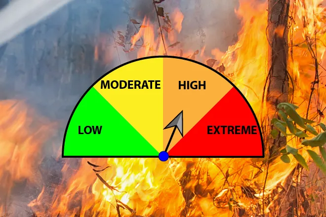
The Red Flag Warning — the highest level of fire weather alert — covered 24 forecast zones issued by the Grand Junction, Pueblo and Boulder offices and runs through Sunday evening. Fire Weather Watches extend the threat into Monday across much of the same high country, and forecasters expect hot, dry, windy weather to persist through much of the week.
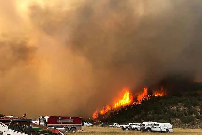
Fires are already burning in Mesa County, in which three firefighters were killed Saturday and prompting a disaster emergency declaration from Governor Jared Polis, as well as Ouray County.
Where the warning is in effect
©
Source: NWS Grand Junction, Pueblo and Boulder Red Flag Warnings via the Iowa Environmental Mesonet — in effect through the evening of June 28, 2026. Times are Mountain.
(Kiowa County Press)
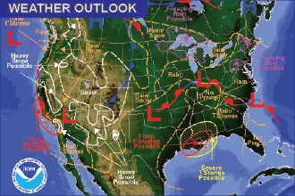
The warning blanketed the western half of the state and the high country — the Colorado, Gunnison and San Juan river basins, the Four Corners, and the central and northern mountains around Grand, Summit, Park and Jackson counties — and reached into the southern mountains, the San Luis Valley and the I-25 corridor from Pueblo south to Walsenburg and Trinidad. Only the far eastern plains, where the week's storms fell, stayed out of the warning.
Why the danger is so high
The same hot, dry and windy pattern that ended the week's storms is now driving the fire danger. Relative humidity is falling into the single digits to low teens across western Colorado, with afternoon winds gusting 30 to 50 mph and temperatures running well above normal over dry fuels. The National Weather Service has cautioned all weekend that under these conditions a new fire could spread quickly, with the lower western valleys and the Four Corners — where the least rain has fallen — most vulnerable. Forecasters at the Grand Junction office also noted that lightning from recent storms can smolder underground for days as so-called holdover fire, then flare into an active wildfire when the weather turns hot, dry and windy.
How long it lasts
Sunday's Red Flag Warning runs through the evening. Fire Weather Watches are already posted for Monday across the central and southern mountains, and the broader hot, dry and windy pattern is forecast to continue through much of the week, with only isolated and mostly dry thunderstorms possible. Meaningful, widespread rain looks unlikely, keeping fire weather in the forecast heading into the Fourth of July.
Preventing fires
With fuels primed to burn, the Weather Service urged residents and visitors to avoid anything that could throw a spark: no open burning and no fireworks, keep vehicle chains off the ground, and hold off on welding, grinding or mowing dry vegetation during the windy afternoons. Obey all local fire restrictions and burn bans, which are in place across much of western and southern Colorado. Report any fire or smoke immediately by calling 911 — under these conditions, a small fire can become dangerous within minutes.