
Blizzard takes hold across southeast Colorado Monday

Note: An updated snowfall map was added at 5:50 a.m. Monday, replacing the original map, to show increased snowfall amounts for counties along the border with Kansas.
A blizzard warning went into effect during the early morning hours Monday as strong winds and snow began to drop into east central and southeast Colorado along the borders with Kansas, Oklahoma, and New Mexico.
Sunday morning, the blizzard warning included Baca, Las Animas, eastern Costilla, and southern Huerfano counties, as well as some neighboring New Mexico counties. By midday, the warning had expanded to Cheyenne County in Colorado, along with a large portion of western Kansas. Further expansion shortly before 3:00 p.m. Sunday included Kiowa, Prowers, and Bent counties in Colorado, as wells as additional areas in New Mexico, Oklahoma panhandle, and northern Texas. South central Nebraska was added to the blizzard-warned area by Monday morning, as were Otero and Kit Carson counties in Colorado. Kit Carson County includes a stretch of Interstate 70 into Kansas.
In total, all of eight Colorado counties and portions of two more fell under blizzard warnings as of 4:30 a.m. Monday.

©
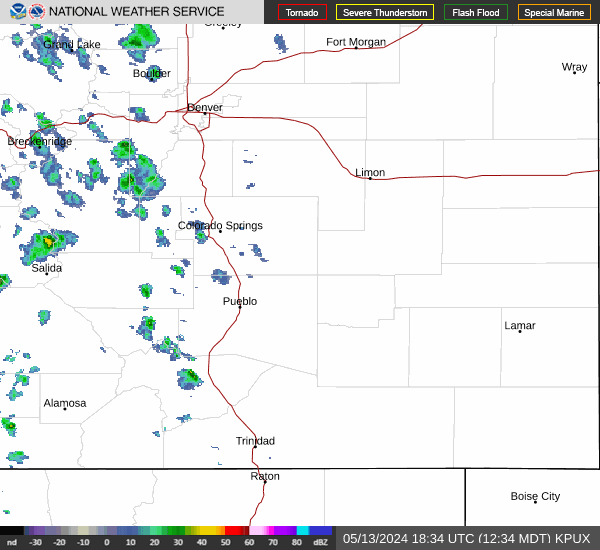
While the Colorado Department of Transportation had not closed any roads due to the storm at 4:30 a.m., most southeast Colorado road were reported as wet. In the Denver metro area and south to Colorado Springs were snowy. Early morning travelers reported snow-covered roads, including Interstate 25, parts of Interstate 70 east of Denver, and Highway 86 from Kiowa to Castle Rock. Other metro roads and highways are expected to have similar conditions as CDOT plows continue initial efforts to clear lanes for the morning commuted. At 5:00 a.m., the CDOT plow tracker showed dozens of plows, potentially well over 100, working roads across the state.
Interstate 70 from Limon to the Kansas border was reported as clear and dry, though conditions are expected to deteriorate throughout the morning.
©
Four to 15 inches of snow are possible, with wind gusts between 60 and 70 miles per hour expected. Blizzard conditions are predicted to persist through early Tuesday morning. The heaviest snow amounts are expected to remain south of Highway 50, mainly in Baca and Las Animas counties. Snowfall rates could reach three inches per hour at times.
Further north, and winter storm warning was issued for northern Lincoln, most of Elbert, and portions of Douglas and El Paso counties. The warning took effect at midnight Sunday, and will continue through 2:00 p.m. Monday. Three to 7 inches of snow are expected in those areas.

©
A winter storm warning is in effect for the foothills and eastern mountains from Boulder county south to the New Mexico state line.
High temperatures Monday are expected to remain at or below freezing, dropping into the low teens or even single digits Monday night. Look for wind chill to be a concern with the low temperatures and strong winds.
A high wind warning will be in effect Monday for Otero and Crowley counties, along with portions of Lincoln, Elbert, El Paso, and Pueblo counties. Gusts up to 70 mph are possible. Snow accumulation in those areas is generally expected to remain below an inch, though a few areas may see higher amounts.
Across the region, snow is expected to diminish by Monday night.
Later in the week, temperatures are predicted to drop below the freezing mark and remain there into the weekend. High temperatures Thursday will be around or slightly above freezing before dropping into the single digits. Some areas may fall below zero Thursday night.
Friday and Saturday, highs in the 20s are forecast before dropping back to around zero each night.
Travel in the area will become difficult over the next 24 to 36 hours, with blowing and drifting snow likely to result in road closures. Delay travel in the warned area if possible. If travel cannot be postponed, drive with extreme caution and be prepared for sudden changes in visibility, and leave extra space between your vehicle and those ahead of you. Keep emergency supplies in your vehicle.
If you become stranded while driving, stay with your vehicle. Run the engine 10 minutes every hour for warmth, and insure the exhaust pipe is clear to avoid carbon monoxide poisoning.
Check the latest road conditions by calling 5-1-1, or visit https://COTrip.org.


