Lamar in for hot, sunny week; gusty Wednesday raises fire-weather caution

Lamar and the rest of Prowers County are heading into a hot, dry stretch with afternoon highs climbing into the lower 90s as early as Monday and pushing into the mid-90s by Thursday, accompanied by gusty afternoon winds at midweek.
Monday is forecast to be sunny with a high near 90 and south-southwest winds of 5 to 15 mph, according to the National Weather Service forecast office in Pueblo. Overnight lows are expected to slip to around 47 under clear skies.
Forecasters at the Pueblo office indicate that an upper-level ridge over the southern Rockies is driving the warmer-than-normal temperatures and dry conditions, with the warmest readings of the week likely on Thursday.
Gusty winds Wednesday; no red flag warning in effect
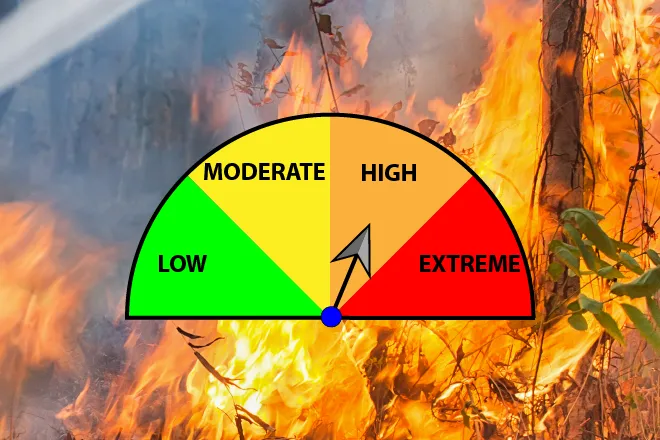
Wednesday is the day to watch for elevated fire weather conditions. The forecast calls for sunny skies, a high near 92, and east-southeast winds increasing to 15 to 20 mph during the afternoon with gusts to 35 mph. As of issuance, the Pueblo office has no active red flag warning for Prowers County (zone COZ236) or any other portion of southeastern Colorado. Even without a formal advisory, the combination of hot temperatures, gusty winds and dry fuels warrants caution with any activity that could produce sparks.
| Period | Sky Conditions | High/Low | Wind |
|---|---|---|---|
| Monday | Sunny | High 90 | S/SW 5-15 mph |
| Monday Night | Clear | Low 47 | S/SE around 5 mph |
| Tuesday | Sunny | High 90 | NW 10-15 mph, becoming NE in the afternoon |
| Tuesday Night | Mostly clear | Low 46 | E 5-15 mph |
| Wednesday | Sunny, breezy | High 92 | ESE 5-10 increasing to 15-20 mph; gusts to 35 mph |
| Wednesday Night | Partly cloudy | Low 51 | S/SE 10-15 mph |
| Thursday | Mostly sunny | High 94 | S 10-15 mph |
| Thursday Night | Partly cloudy | Low 50 | ESE 5-10 mph, shifting NNW after midnight |
| Friday | Sunny | High 92 | NW 10-15 mph, becoming E in the afternoon |
Source: National Weather Service, Pueblo, Colo. — Issued Friday, May 8, 2026
(Kiowa County Press)
Tuesday and Wednesday
Tuesday continues sunny with another high near 90. Winds start out of the northwest at 10 to 15 mph in the morning before turning out of the northeast in the afternoon. Tuesday night drops to around 46 with mostly clear skies and east winds of 5 to 15 mph.
Wednesday's gusty east-southeast winds and afternoon temperatures near 92 mark the most weather-sensitive day of the period. Wednesday night turns partly cloudy with a low around 51 and continued south-southeast winds of 10 to 15 mph.
Extended outlook: Thursday and Friday
The warmest days of the work week arrive at the end. Thursday is forecast mostly sunny with a high near 94 and south winds of 10 to 15 mph. Friday continues sunny with a high near 92 and winds shifting from the northwest to the east through the day.
The Climate Prediction Center's 6- to 10-day outlook favors above-normal temperatures across Colorado, with near-normal precipitation chances. The 8- to 14-day outlook continues the above-normal temperature signal while leaning toward below-normal precipitation across the state. For southeastern Colorado, that pattern points to continued heat and dryness into the following week.
Residents along the Arkansas Valley are reminded that fire risk rises quickly when daytime temperatures climb into the 90s with low humidity and afternoon wind gusts. Cured grasses and dry brush can carry fire rapidly, particularly Wednesday and Thursday afternoons.