Heat builds over Eads with critical fire weather likely by Sunday

Kiowa County Press Staff
(Kiowa County Press)
Sunny skies and rising temperatures are in store for Eads through the weekend, with highs climbing from the lower 90s Friday to between 96 and 100 degrees by Sunday, as forecasters warn that critical fire weather conditions are likely to develop across western Kiowa County by the start of next week.
Friday brings full sunshine to the Eads area, with highs in the lower to mid 90s and north winds of 10 to 15 mph. Skies stay partly cloudy Friday night as lows settle in the mid to upper 50s and winds turn to the southeast around 10 mph.
The National Weather Service in Pueblo said the broader pattern is trending hotter and drier. “Conditions will continue to warm and dry, with above average temperatures predicted over most of southeast Colorado,” forecasters wrote in Friday’s Area Forecast Discussion, adding that daily showers and thunderstorms are possible into early next week “though coverage will be spotty and most of the area will remain dry.”
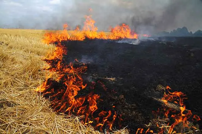
Building heat and fire weather concern
An upper-level ridge will strengthen over southeastern Colorado through the weekend, pushing afternoon highs toward the upper 90s and, in spots, near 100 degrees. As westerly winds increase early next week and relative humidity falls, the weather service said critical fire weather conditions become “more and more likely from Sunday through the middle next week,” with the driest air potentially dropping humidity into the single digits.
Isolated high-based showers may form over the higher terrain in the afternoons, but forecasters said the main hazards would be gusty outflow winds and lightning rather than meaningful rainfall.
Eads, Colo. — Five-day forecast (June 5–9, 2026)
Source: National Weather Service, Pueblo — Issued June 5, 2026
| Period | Sky Conditions | High / Low | Wind |
|---|---|---|---|
| Friday | Sunny | 90–95° | N 10–15 mph |
| Friday night | Partly cloudy | 55–59° | SE around 10 mph |
| Saturday | Mostly sunny | 90–95° | SE 10–20 mph, gusts to 35 mph |
| Saturday night | Partly cloudy | 55–59° | SE 10–20 mph |
| Sunday | Sunny | 96–100° | S 10–15 mph |
| Sunday night | Partly cloudy | ~60° | — |
| Monday | Sunny | 90–95° | — |
| Monday night | Partly cloudy | 57–59° | — |
| Tuesday | Partly cloudy | 98–101° | — |
| Tuesday night | Partly cloudy, windy | 60–65° | Windy |
(Kiowa County Press)
Saturday and Sunday
Saturday stays mostly sunny and warm, with highs again in the lower to mid 90s and southeast winds of 10 to 20 mph gusting to around 35 mph. Lows Saturday night hold in the mid to upper 50s. Sunday turns hot and sunny, with highs of 96 to 100 degrees and south winds of 10 to 15 mph, the peak of the weekend warm-up.
Extended outlook
The hot, dry pattern continues into next week. Monday is sunny with highs in the lower to mid 90s, followed by a warmer Tuesday with highs near 98 to 101 degrees. Winds pick up Tuesday night, and forecasters expect elevated to critical fire weather to persist through the middle of next week as temperatures climb further.
With humidity falling and fuels curing, residents are encouraged to avoid outdoor burning and to use caution with any potential ignition sources, particularly during the windy afternoon hours expected Sunday and beyond.